Validated · Industrial pilot

Proof It Works.

Trained in simulation. Validated in reality. Numbers, side-by-sides, an interactive coordinate mapper, and the road from here.

01 / Current results

What's running today.

Headline numbers measured on a fixed industrial camera during the pilot. All measurements against real factory footage; the training set was 100% synthetic.

Reprojection
6.8px
Mean pixel error mapping detections back to UWB ground truth.
measured · field
Training data
100%
Synthetic-only training set. Zero real labels, zero annotation hours.
simvera-cones-v3
Calibration points
7
Known floor points used to fit the pixel → world polynomial.
OLS · 2D polynomial
Inference
Real-time
Continuous detection on industrial RTSP feeds at edge.
tensorrt · fp16
02 / Side by side

Simvera vs Traditional Approach.

Same detection target, same hardware, same accuracy — the difference is what you have to do to get there.

Aspect
Traditional
Simvera
Data collection
Weeks per object class
Hours↓ 99%
Manual labeling
Thousands of images
Zeronone required
New environment
Full re-collection
Re-render in simovernight
Time to deploy
3 – 6 months
48 hours↓ 60×
Cost per class
$10K – $50K
< $500↓ 20×+
03 / Tool preview

Coordinate Mapper — recorded session.

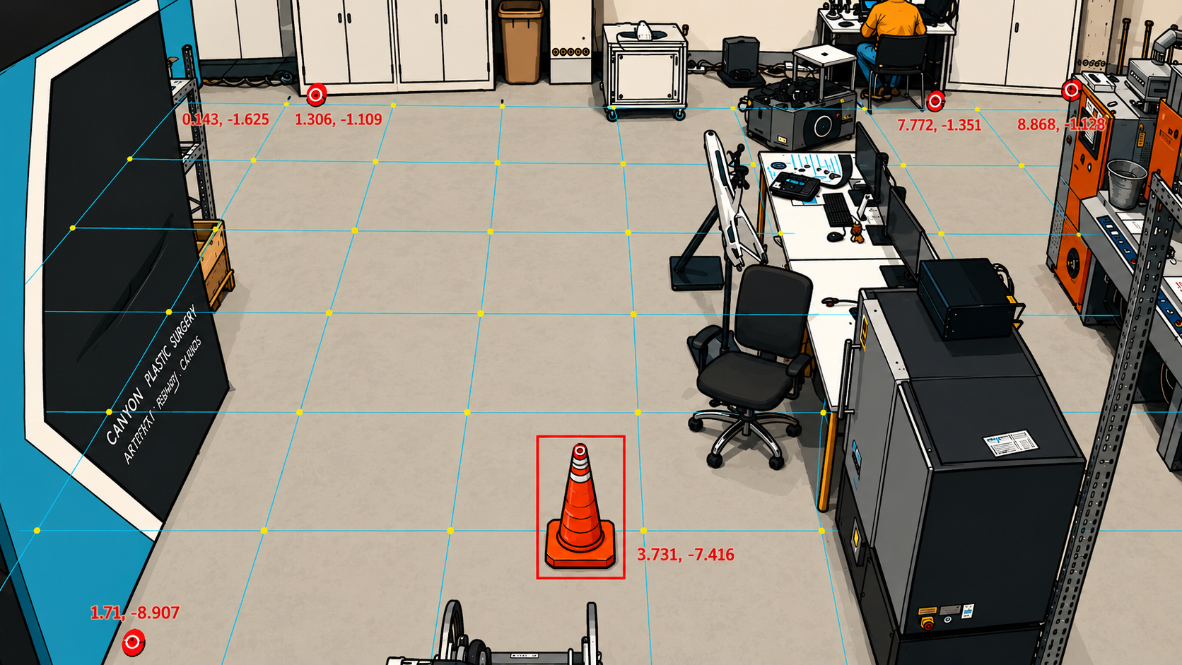
Same tool used in the field. This preview uses a fixed factory frame — click anywhere on the floor to explore pixel→world mapping. Fitted against seven known calibration points (marked in the frame).

· field deployment · snapshot ● demo mode
Recorded factory frame with detection overlay and world-coordinate grid
SNAPSHOT · recorded 1920 × 1080
CLICK  anywhere on the floor floor mapping · v3

Readout

pixel — , —
world — m, — m
distance
error
7 calibration points (known XY)
Your query point
Interactive preview built from a real factory frame and calibration. Not a live stream.
04 / Validation methodology

How we know the numbers are real.

We validate sim-to-real transfer by comparing model predictions on factory camera feeds against known UWB ground-truth positions. The polynomial mapping was fitted using Ordinary Least Squares and validated against 7 calibration points with known world coordinates.

Ground truth
UWB
Fit
OLS
Calibration
7 pts
05 / Where this is heading

From one cone to a hazard library.

Two milestones shipped, three ahead. Cyan dots are complete; the rest is on the schedule.

Q2 2025

First object class trained and deployed.

Traffic cone detector, 100% synthetic training. Deployed on an industrial pilot site.

Q3 2025

Coordinate mapping system validated.

7-point OLS calibration · 6.8px mean error vs UWB ground truth.

Q1 2026

Scale to 10 object classes.

Barriers, signs, pallets, debris — the everyday factory hazard set.

Q3 2026

Multi-camera fusion + tunnel.

Detections fused across cameras, generalised to tunnel-like environments.

2027

Commercial pilot.

First paid deployment with a manufacturing partner.