Solutions

One engine. Two ways to deploy it.

Most safety questions can be answered on your cameras today, with nothing to label and nothing to train. The objects that are specific to your plant cannot. We built one engine that covers both, and you can start on either side of it.

Track 01 · Ready to deploy · Path A

Nothing to label. Nothing to train.

Three deployments that run on your existing cameras with no dataset of yours. A new hazard is a sentence, not a training run.

How Path A works →  ·  Try it on the demo →  ·  On-premise, no footage leaves the site
01 / Industrial · Fixed cameras
Factory floor Overhead CCTV Person distance
// Where must nobody go, and who is too close?

No-Go Zone Mapping.

Factories cordon off areas every day: a press under maintenance, a wet floor, a robot cell. The cordon is obvious to a person and invisible to a robot. Simvera reads whatever the crew put down, returns the enclosed floor as a zone, and measures how far every person is from it.
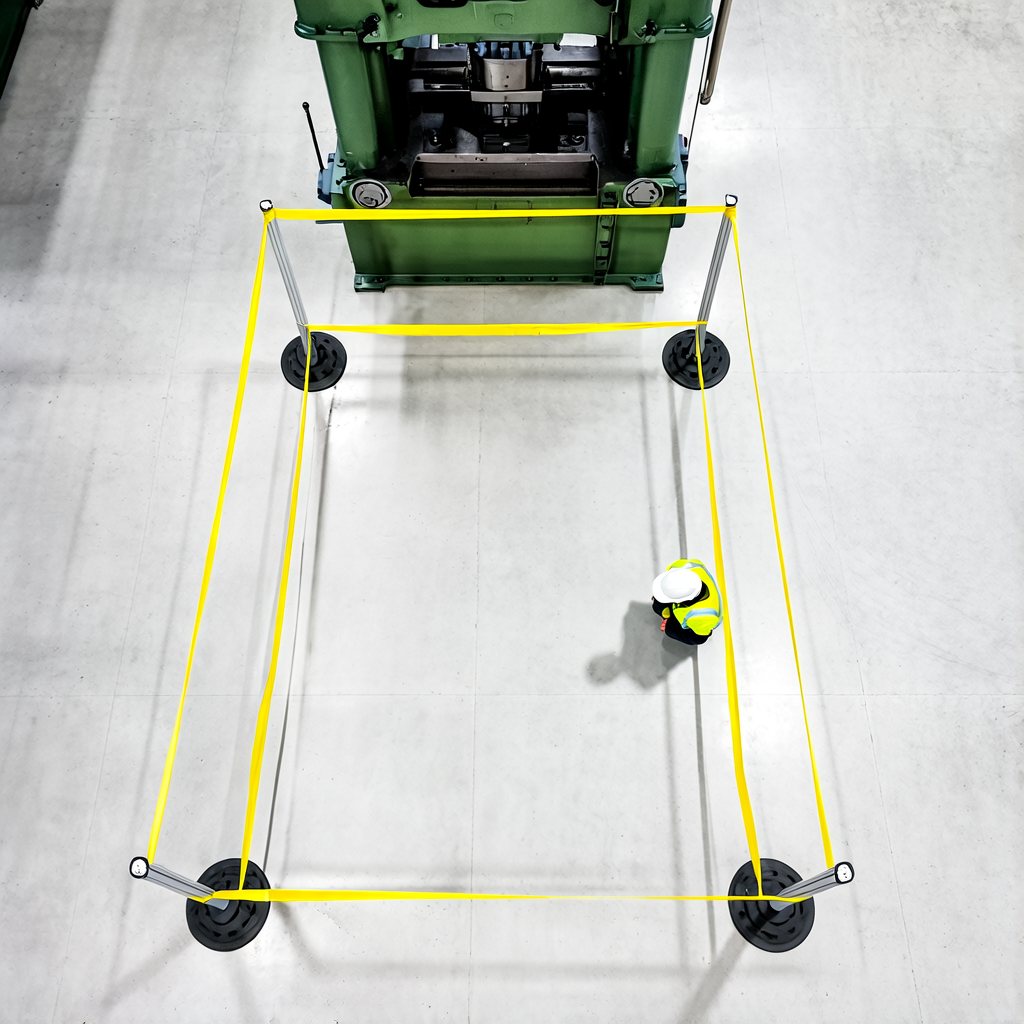
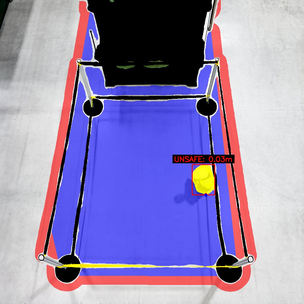
Factory floor with a press cordoned by yellow caution tape, a worker standing inside the cordon Same scene with the enclosed floor filled as a no-go zone, a red safety margin around it, and the worker masked and labelled UNSAFE at 0.03 m
Camera frame Zone + person distance
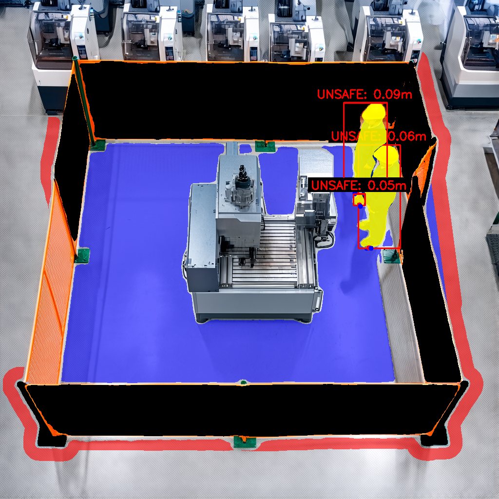
Machine cell fenced with orange mesh, three workers just inside the fence masked yellow and each labelled UNSAFE with their distance to the zone
Inside the fence3 unsafe · 0.05 to 0.09 m
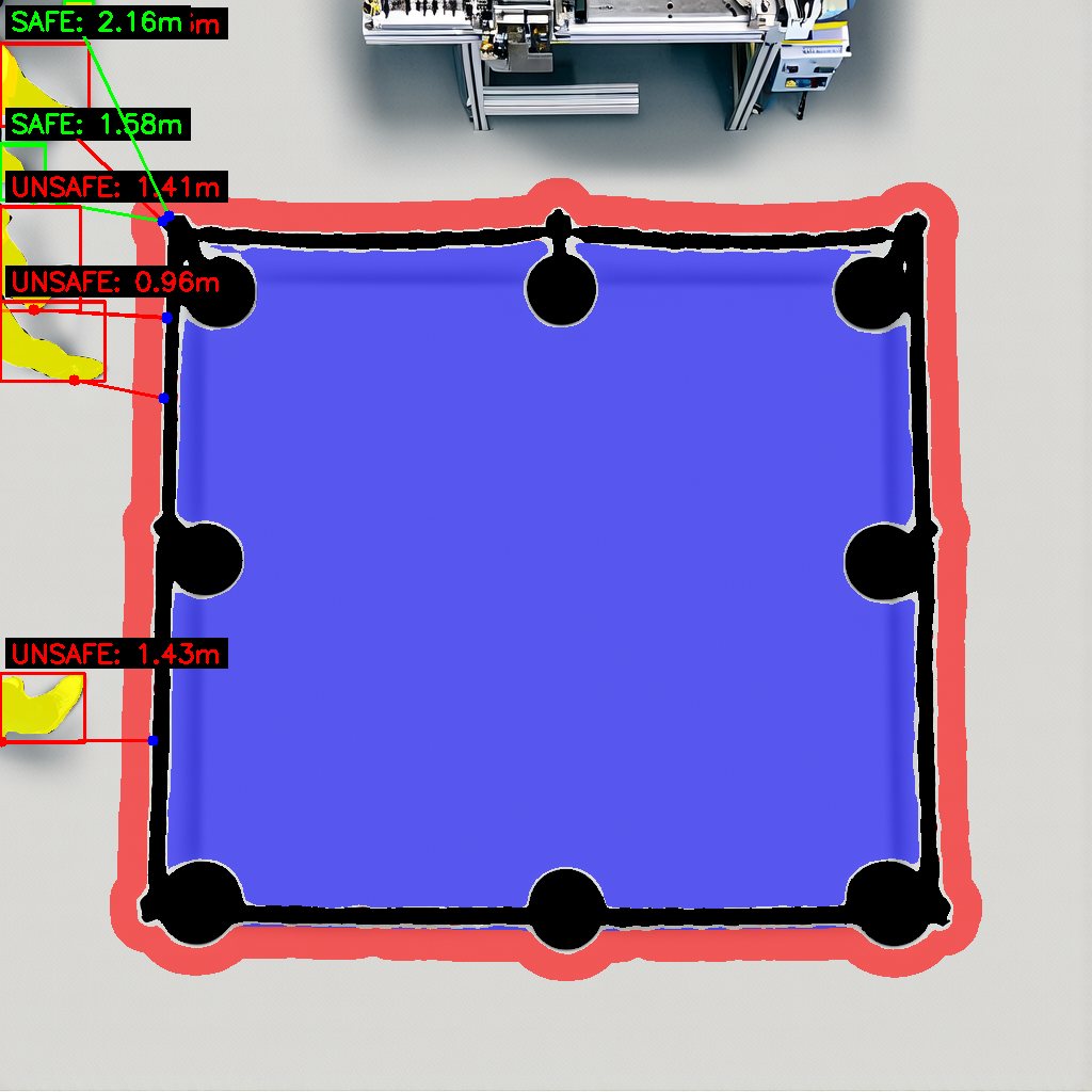
Zone cordoned with plastic chains on posts, five people outside it each labelled with their distance, two marked SAFE and three UNSAFE
Outside the chainssafe past 1.5 m
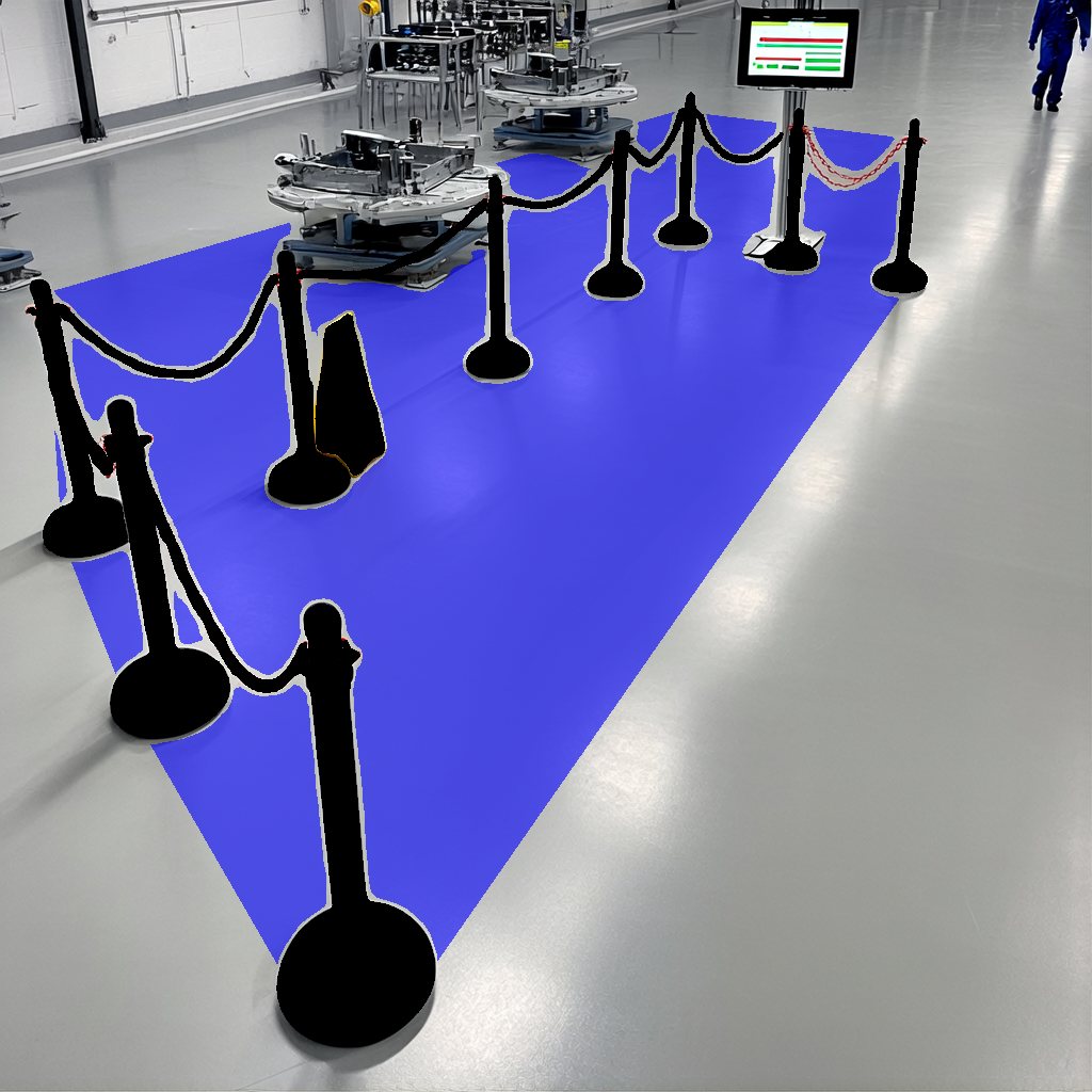
Belt stanchions around a machine cell, enclosed floor filled as a zone
Belt stanchions1 zone
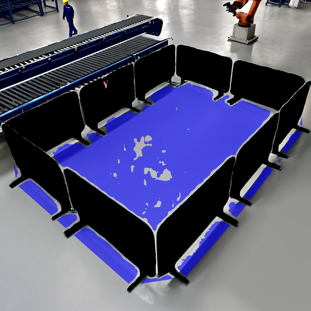
Metal crowd barriers around a work area, floor inside filled as a zone
Metal barriers1 zone
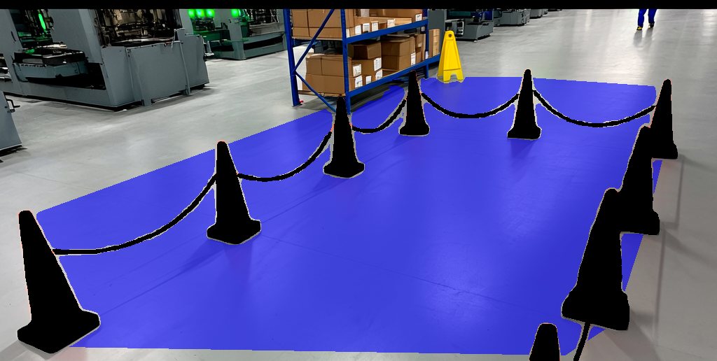
Cones linked with chain in a warehouse aisle, enclosed floor filled as a zone
Cones & chain1 zone

What it does

  • Finds every cordon in the frame, however it was built, and rates how clearly it reads.
  • Segments the boundary objects, then closes them into a hull and shrinks it slightly inward so the zone stays on the safe side of the tape.
  • Segments only the floor inside that hull. Machines, people and shelving inside the cordon are not painted.
  • Grows a safety margin around the zone, then measures each person's distance to the boundary in metres. Inside the zone or the margin is UNSAFE, beyond the threshold is SAFE.
  • Emits the zone as a mask and a bounding box, ready to project onto floor coordinates. Same camera-to-world mapping we use for cone localisation.

Cordon types handled

Caution tapeTraffic conesBelt stanchionsPlastic chains Metal barriersJersey barriersPainted floor linesPaper stripsImprovised: chairs, pallets

Output record

// zone_output_03_nogo_caution_tape.json
{ "zone_id": "hazard_zone_1",
  "visibility_rating": 95,
  "large_bounding_box": [330, 70, 890, 940],
  "boundary": ["yellow caution tape",
                "metal stanchion posts", …],
  "floor":    ["smooth grey factory floor", …],
  "persons":  [{ "id": 1,
                "distance_m": 0.03,
                "status": "UNSAFE" }] }
One record per zone, one entry per person. Boxes are normalised 0–1000 so they survive any camera resolution.
Where it fits. Feed zones to AGV fleet managers as dynamic keep-out polygons, raise an alert the moment a person's distance drops below the threshold, or keep the digital twin's floor map in sync with what the crew actually cordoned.
02 / Industrial · Fixed cameras
Factory floor Overhead CCTV Safety compliance
// What is dangerous right now, and who is exposed?

Hazard & PPE Auditing.

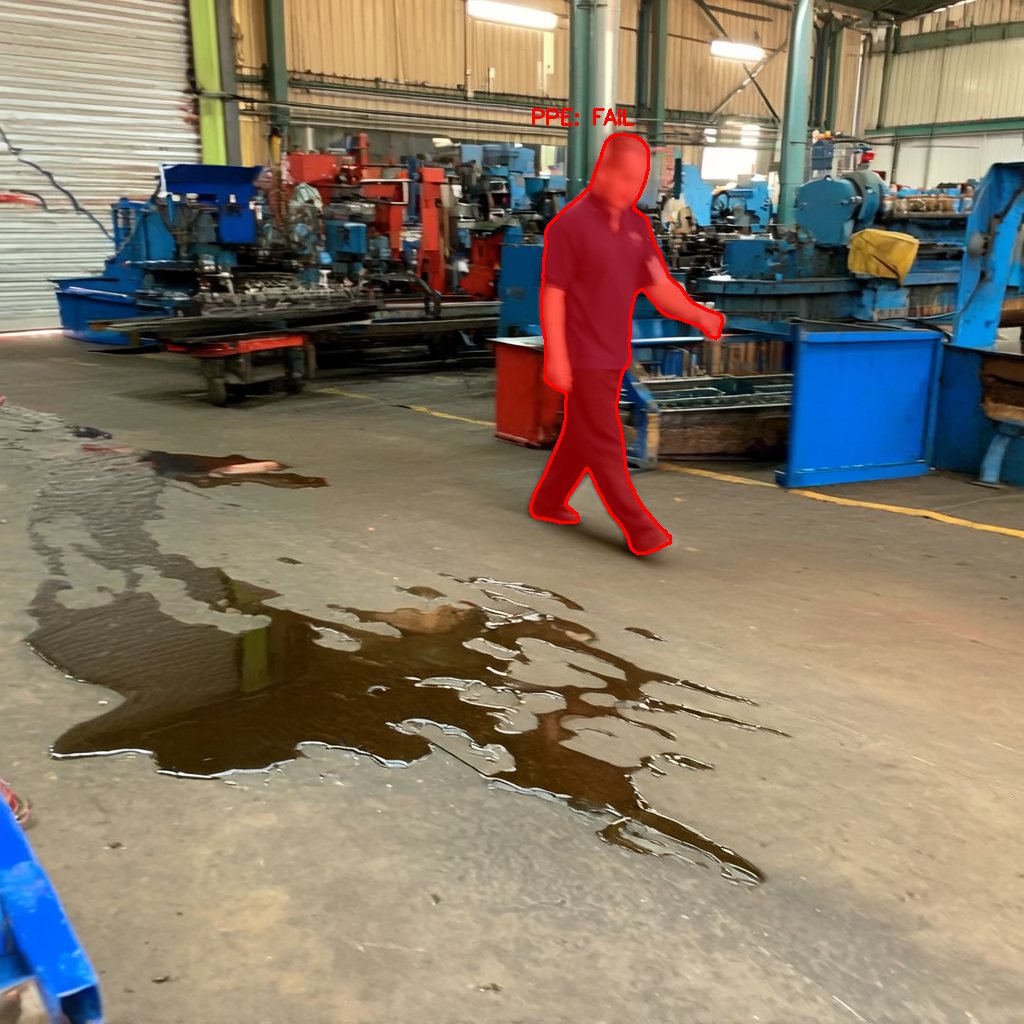
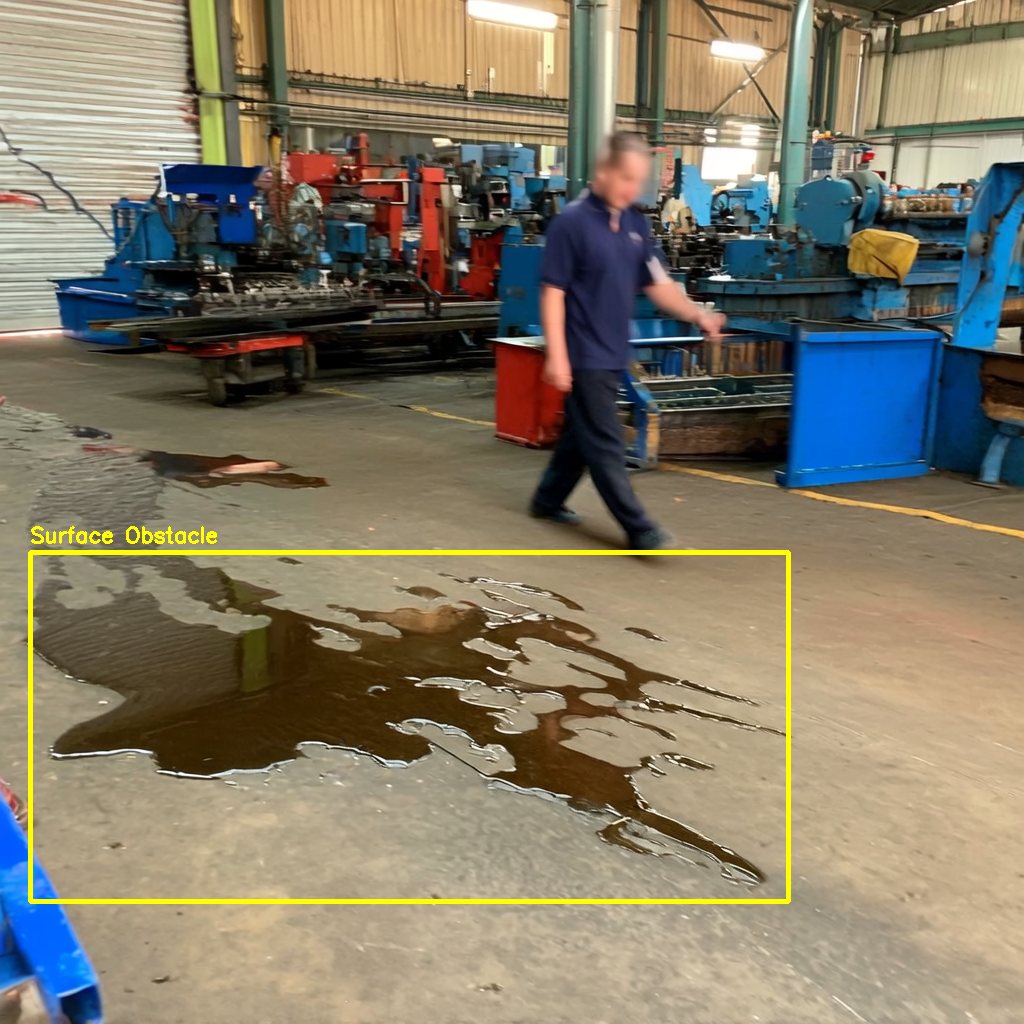
Most incidents happen where nothing was cordoned. A spill nobody reported, a cable across a walkway, a load overhead. Simvera treats every frame as a safety walk: it lists what is in the scene, judges what could hurt someone, and checks who is standing next to it.

Workshop floor with an oil spill boxed and labelled Surface Obstacle Same scene with the worker next to the spill masked in red and labelled PPE FAIL
Hazard grounded Exposure check
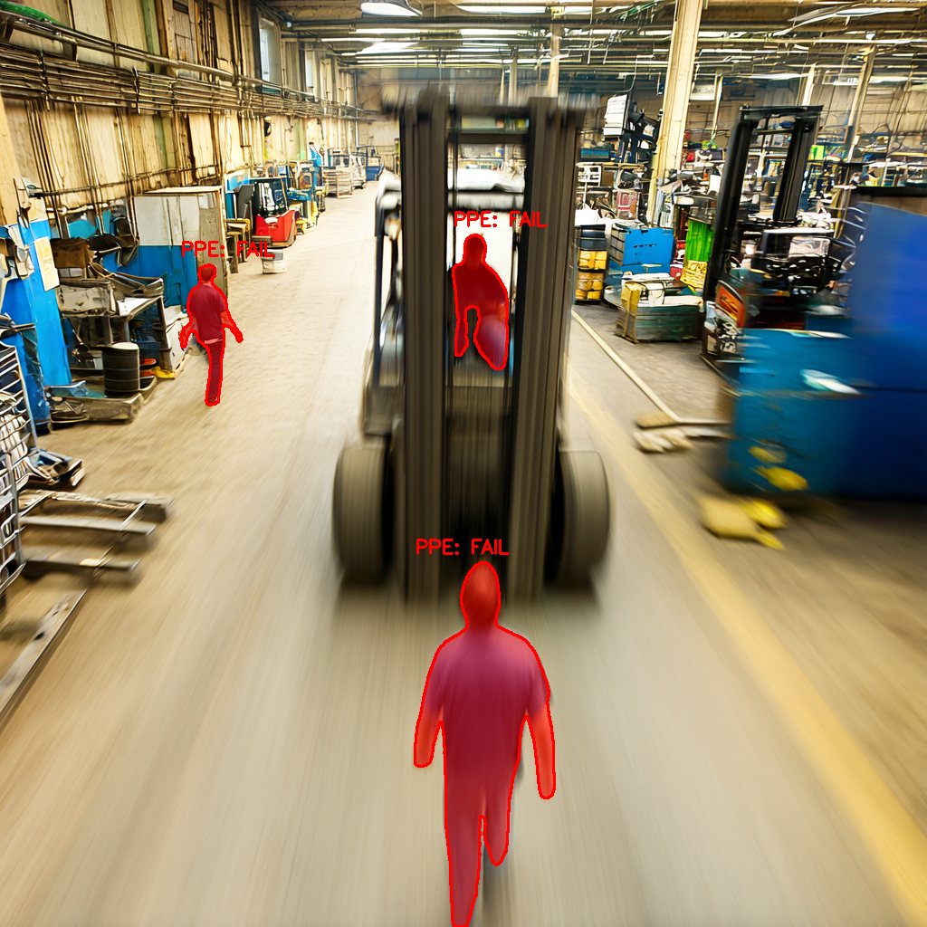
Forklift driving down an aisle with three workers in its path masked red
Moving forklift3 exposed
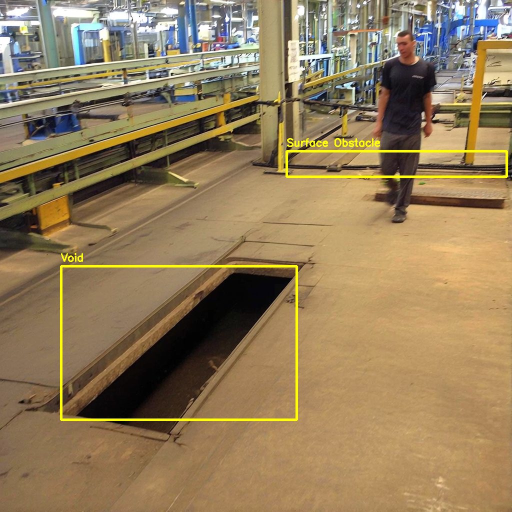
Open floor pit labelled Void and a cable run labelled Surface Obstacle
Floor opening2 hazards
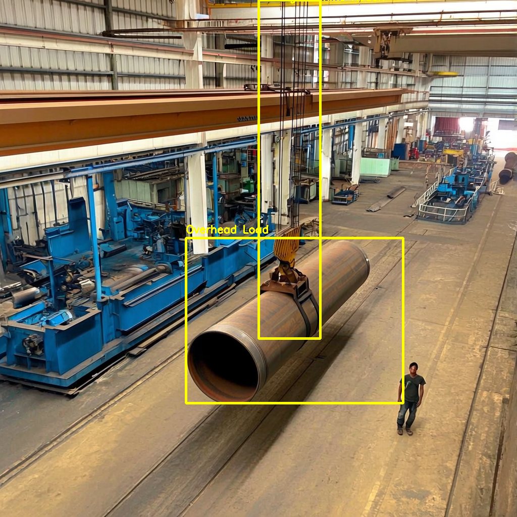
Steel pipe suspended from a crane boxed and labelled Overhead Load
Suspended load1 hazard

What it does

  • Inventory. Catalogues every entity in the frame with its category and what it is resting on.
  • Kinematics. For people and machines: moving or still, posture, PPE visible, guards in place.
  • Arbitration. Scores each candidate hazard, keeps those above threshold, and writes a plain-language justification for each one. People are never flagged as hazards.
  • Exposure. Grounds the hazard as a mask, grows it into a danger zone, and checks every person inside it for the PPE that hazard requires.

Hazard classes covered

Floor spillsMoving forkliftsSuspended loadsFloor openings Loose cables & hosesUnguarded edgesRobot sweep radiusConveyor pinch points Live electrical panelsUnstable stacksFire & welding sparksBlocked exits

Output record

// pipeline_results_04_spill_slip_day.json
{ "hazard_id": "HAZ-01",
  "hazard_type": "Environmental",
  "danger_probability": 85,
  "justification": "Uncontained fluid spill covers the walking
    surface. Worker is crossing its edge with no PPE…",
  "target_phrase": "spill, puddle, fluid, liquid",
  "target_box": [220, 0, 1000, 1000] }
Every finding carries its reasoning. An auditor can read why the system flagged it, not just that it did.
Where it fits. Continuous safety audit from existing cameras with a written justification per finding, which is exactly what EU machinery and AI Act documentation asks for. Route alerts to the shift lead, or log them for near-miss statistics.
03 / Automotive & road operators · Moving cameras
Dashcam & roadside Highways, tunnels, mountain roads Driver alerts
// Is the road ahead clear?

Road Debris Detection.

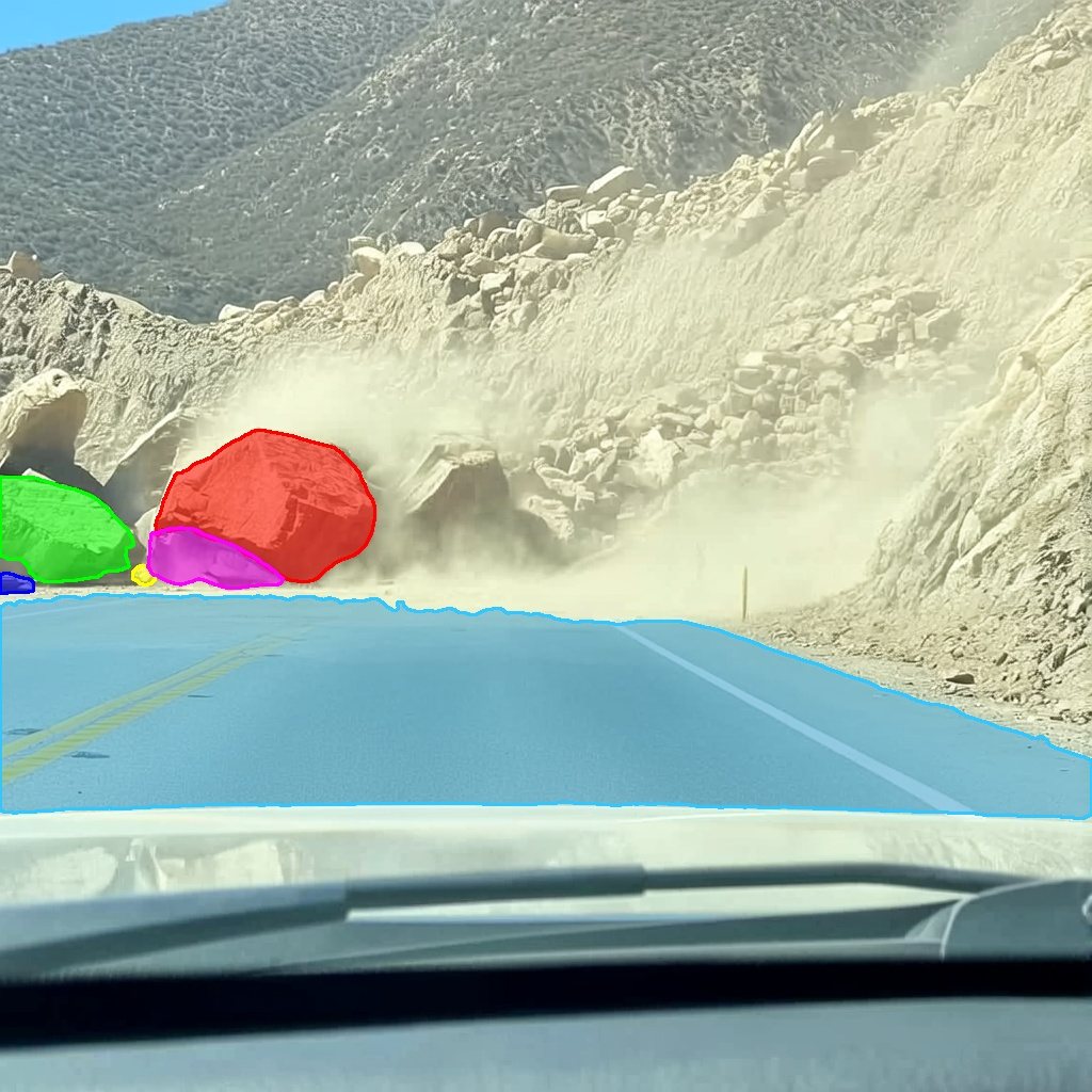
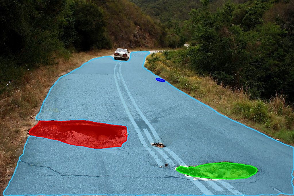
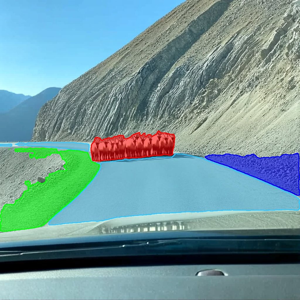
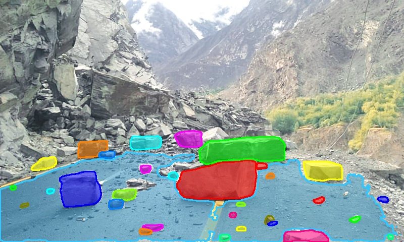
Nobody can train a detector for every object that can end up on a road. Simvera does not try. It segments the drivable surface first, then flags anything on it that is not a vehicle: rockfall, dropped cargo, potholes, animals, a stray cone. The class list is a text file.

Dashcam view of a rockfall on a mountain road with the road masked blue and each boulder masked in a separate colour
Active rockfall, dashcamroad + 5 obstructions
Country road with a pothole masked red and a second surface defect masked green
Potholes2 flagged
Herd of animals on a mountain road masked red with roadside rubble masked green and blue
Animals on road3 flagged
Road blocked by a landslide with dozens of rocks individually masked
Landslide20+ flagged
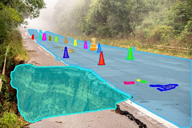
Collapsed road edge masked cyan with a line of cones each masked separately
Road collapse & conesday, fog
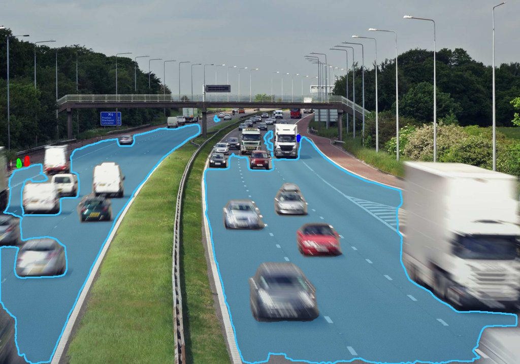
Busy motorway with both carriageways masked blue and no false detections on vehicles
Busy motorway0 false alarms on traffic

What it does

  • Segments the road first, so only objects touching the drivable surface can raise an alert. Roadside rubble is ignored.
  • Sweeps a vehicle vocabulary and a fifty-phrase obstruction vocabulary in one pass. Anything overlapping a vehicle is suppressed.
  • Deduplicates overlapping masks and reports each obstruction with its score and how much of it sits on the road.
  • Runs on frames from a moving camera and adapts to daylight, dusk and night footage without retraining.

Obstruction vocabulary

Rocks & bouldersPotholesSpilled cargo & boxesAnimals Fallen treesTyre tread & metal scrapCones & barriersPedestrians Fallen bikes & scootersBags & textilesStalled machineryUnidentified object

Output record

// POST /v1/segment  →  one entry per obstruction
{ "label": "boulder",
  "score": 0.87,
  "bbox": [148, 402, 352, 548],
  "road_overlap": 0.94,
  "mask": "<png, base64>" }
Served as a microservice. A vehicle stack or a control room calls it per frame and decides what to do with the answer.
Where it fits. Driver-assistance alerts on the vehicle, incident detection on tunnel and motorway cameras where GNSS is unreliable, and automated lane-clear checks after a rockfall or storm.
Track 02 · Built for your objects · Path B

When the object is yours.

A general vocabulary has never seen your tooling, your fixtures, or the part that comes off your line. For those we render the object in simulation and train a detector you keep, sized for edge hardware.

04 / Custom class · Live pilot
Live · cam-04 Fixed factory camera Robot & AGV routing
// What if the object is yours?

The Cone Pilot.

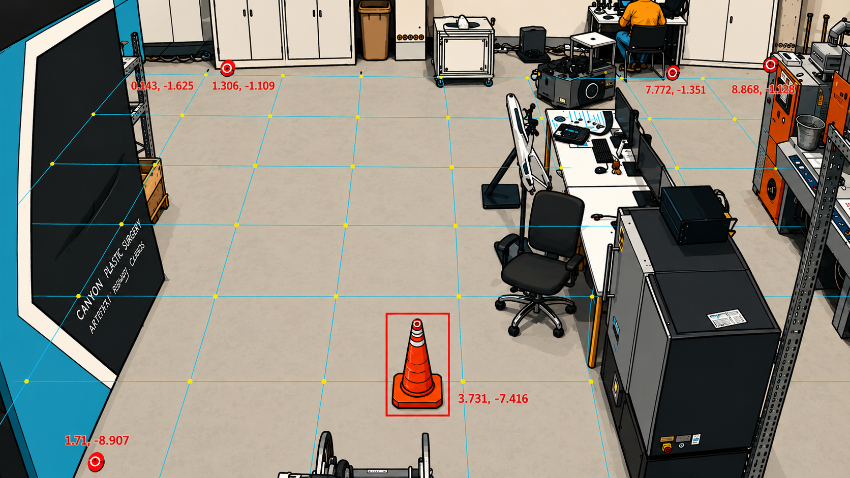
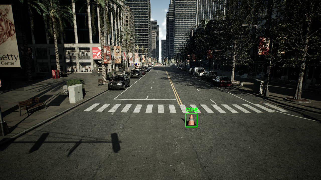
A cone marks a hazard on the floor, and a robot has to know where it is in metres, not pixels. No public dataset shows cones under plant lighting from a ceiling camera. This one was rendered, trained and put live on a real feed, and it is the same path any object of yours takes.

Live factory camera feed with a world-coordinate grid overlay, a detected cone boxed in red and labelled with its floor coordinates
Detection mapped to floor coordinatescam-04 · live
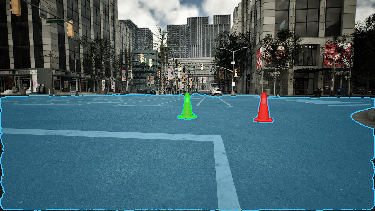
Rendered street scene with the drivable surface masked blue and two cones each masked in a separate colour
Rendered framelabels come free
Rendered city street where the trained detector has boxed and labelled a single small cone far down the road
Detector on a held-out rendersmall, distant, found

What it does

  • Detects the cone in real time on a fixed factory camera, at a few milliseconds per frame on edge hardware.
  • Projects each detection onto floor coordinates, so a fleet manager or a safety zone gets a position in metres.
  • Trained entirely on rendered frames. Not one real image was labelled by hand.
  • Validated against a held-out clip from the real feed before going live.

What you bring

A photo or a CAD fileA short clip from your cameraThat is all

Output record

// cam-04 · one entry per detection
{ "class": "traffic_cone",
  "score": 0.94,
  "bbox": [764, 617, 889, 823],
  "world_xy": [3.731, -7.416],
  "unit": "m, floor plane" }
Pixels are the intermediate result. Floor coordinates are what a fleet manager or a safety zone can actually act on.
Where it fits. Robot and AGV routing around live hazards, keep-out enforcement in metres rather than pixels, and any plant-specific object that a general vocabulary cannot name. The detector family behind it, four sizes from edge to server, is on the Benchmarks page →
05 / Market opportunity

Market Opportunity.

Three forces are pushing cameras to get smarter, on factory floors and on the road. Each one runs into the same bottleneck. The data to train these systems is slow, expensive, and hand-labeled. That bottleneck is where Simvera sits.

Industrial AI vision
The demand
Cameras getting smarter
Detection on the factory floor
Safety, defect detection, and autonomy all lean on visual perception. Adoption is climbing, but every deployment stalls at the same labeling wall.
Digital twin
The substrate
Simulation is ready
Simulation of the physical world
Photoreal simulators like Omniverse and CARLA are already in place. We turn them into a training-data factory instead of just a visualization tool.
Factory safety compliance
The pressure
Regulation is here
EU AI Act · machinery regulations
Operators must monitor more, document more, and react faster. Camera-based perception is the only way to meet that at scale.
Demand, substrate, and pressure all point to one gap. Simvera fills it.